Showing posts with label #AFR100. Show all posts

Friday, August 6, 2021

Seedballs vs. Seed eaters

Finally! A video that's taken a long time to get 🙂 Here's a very cute and relaxed little grass rat (unstriped Nile grass rat, Arvicanthis niloticus) near Shompole chowing down on some grass seeds and not even paying the slightest attention to the grass seedballs right next to it 😃


Some vervet monkeys rejecting some acacia tree seedballs as 'not fit to eat' near Lake Elementaita.

Sunday, July 21, 2019

Drones, Data and Forestry

The linkages between UAV's (Unmanned Aerial Vehicles), forestry and eco-system management have only just begun to mature. There is extensive potential for these tools to fill in gaps in current practices while providing thousands of 'green coller' digital jobs in the environmental service industry in East Africa.

Below are some links and information about drones for forest landscape management, mapping and restoration.


1. Forest mapping and biodiversity

Drones of various shapes, sizes, and functionalities have emerged over the past few decades, and their civilian applications are becoming increasingly appealing. Flexible, low-cost, and high-resolution remote sensing systems that use drones as platforms are important for filling data gaps and supplementing the capabilities of crewed/manned aircraft and satellite remote sensing systems. Here, we refer to this growing remote sensing initiative as drone remote sensing and explain its unique advantages in forestry research and practices. Furthermore, we summarize the various approaches of drone remote sensing to surveying forests, mapping canopy gaps, measuring forest canopy height, tracking forest wildfires, and supporting intensive forest management. The benefits of drone remote sensing include low material and operational costs, flexible control of spatial and temporal resolution, high-intensity data collection, and the absence of risk to crews. The current forestry applications of drone remote sensing are still at an experimental stage, but they are expected to expand rapidly. To better guide the development of drone remote sensing for sustainable forestry, it is important to systematically and continuously conduct comparative studies to determine the appropriate drone remote sensing technologies for various forest conditions and/or forestry applications. Link to paper> © 2015, Northeast Forestry University and Springer-Verlag Berlin Heidelberg.

2. Precision forestry and forestry management

Different parameters relating to forests such as the extent of canopy cover, the number and species composition of trees and volume estimation can also be achieved efficiently through the use of unmanned aircrafts. This data collected by use of drones are usually accurate and can help in quick and better decision making as opposed to other methods.

3. Mapping canopy gaps

Forest disturbances are mostly caused by storms or human interference and these have a direct impact on the productivity of forest stands. This also affects regeneration. Satellite imagery was initially used to access this kind of data by mapping the canopy gaps but the information was not as accurate as it needed to be. This however changed with the introduction of drone remote sensing.

4. Measuring forest canopy gaps and other important attributes

Canopy heights and other canopy attributes are some of the best features of forest used by forest professionals. This data needs to be accessed accurately and thanks to LiDAR technology that can now be mounted on drones, the information can be accessed fast and efficiently.


5. Capturing forest data

Drones can now be used to capture vital forest data such as planting success rates, vegetation change and health, canopy attributes such as canopy gaps, canopy heights and even the extent of carbon storage within a forest. This information is not only relevant to forest researchers but also to forest farmers.


6. 3D mapping for carbon storage

In the past, measuring the extent of carbon storage in biomass has been very labor intensive and very expensive. But thanks to the introduction of drone technology, remote sensing can now be used to get 3D mapping of carbon storage within forests of many types.

7. Restoration of scorched land and firefighting support

Wild fires often cause extensive damage to land and soil after the fire has been extinguished. The process of land restoration is what takes years as it requires extensive land survey and tree planting that could take years. Drones can be used to do these surveys fast and reduce the cost and time of land restoration and aerial seeding.


Drones can even be used in firefighting. Using a built in camera, a firetower is able to detect the thermal signature of forest fires that are beginning within a 15-km (9-mile) radius of itself.

When a fire is detected, the tower's computer determines the geographical location of the blaze, and then "awakens" the drone by sending it an email with those coordinates – that same email is also sent to a fire-fighting crew at a base station. The GPS-guided drone proceeds to autonomously fly out to the fire, using its own thermal and optical cameras to obtain and transmit visuals back to the firefighters.
https://newatlas.com/forest-fire-drone/60213/

https://uavcoach.com/drones-fire-departments/

Take, for example the FVR-90, a fixed-wing drone with a 14-foot wingspan capable of traveling at speeds up to 80 knots, or 46 mph, with a flight time of 8 hours. They are sent airborne just at dusk when other human-piloted flights are grounded. The sky is theirs, and the overhead view they have of the fire is detailed and in real time.

“The way we use UAS now is very much a supplement,” said Justin Baxter, the Forest Service National UAS Operations Specialist. “There are certain times that it’s just not safe for us to utilize manned helicopters or fixed-wing aircraft, like nighttime operations or in thick smoke or high winds. But during those times there are still firefighters out there trying to complete the day's objectives and put the fire out.”

The drones that Baxter and his team fly are equipped with cameras that are not your normal cameras. They come equipped with multiple types of sensors, including infrared, that allow the team to see through smoke and, at night, see heat signatures, or thermal-based imaging. This allows the team to identify areas where fire is still active and new areas where flames have advanced, such as spot fires. https://www.fs.usda.gov/features/mechanized-birds-wildland-firefighting-drone-intelligence 


8. Tree planting with drones 🌱🌱

Planting trees in remote areas hard to reach is not an easy task. The land is often not evenly distributed and it is sometimes inaccessible. Drones can be used to distribute seeds and seedballs in these areas in a fast and efficient manner and ensure adequate seed distribution rates. (Longer detailed blog on aerial seed application in East Africa here (https://seedballskenya.blogspot.com/2016/08/application-of-plant-seed-using-aircraft.html) 


Drone seeding in Somalia with UNSOM and Seedballs Kenya https://unsos.unmissions.org/reforesting-somalia 


The first KCAA licensed drone seed dropping demo in Kenya by KENDRONE in Mombasa https://www.facebook.com/KendroneKenya/videos/182002460455388 


Some companies are even looking into using drones for tree seed collection:


9. Forest surveillance

Drones are now being used to do aerial surveys of rainforests to determine where the trees have been affected by human activities and the patterns being used to achieve this. Drones can then relay the data to the relevant authorities who use it to make informed decisions.


10. Monitoring illegal quarrying

Drones can be used to monitor illegal quarrying especially in forested areas that cannot be easily accessible by humans. Drones can fly over these areas and take clear shots of the damage that has been caused in these areas and advise authorities on corrective measures to take.

12. For dropping fertilizer or spraying herbicides

One of the toughest and labor intensive jobs is the sprinkling of fertilizer/herbicides in forested areas. Drones have come in handy in helping to spread fertilizer etc. over forested areas that were previously inaccessible. And also reduce exposure to human operators for dangers herbicides.


15. Forest security

A lot of forest cover is being lost to unscrupulous business people through logging and this ends up causing global warming. Law enforcement authorities have also employed the use of drones to do forest cover monitoring to arrest the people who are destroying them.                      


The following is a list of some recent research and news articles as well as links to just a few of the various companies offering Forestry/UAV related services in Kenya:

https://www.expertdrones.com/eastafrica


Monday, May 6, 2019

Biodiversity enrichment of old charcoal kiln sites in Narok.


Aerial application of 300kgs of mixed indigenous acacia tree seedballs on an area that was illegally degraded by charcoal makers who mostly targeted mature acacia trees near Aitong, Narok South, Kenya.


November 2018


A rudimentary method of seed application. What is needed is a http://www.helispread.com/ bucket.

But effective for biodiversity enrichment programs where straight lines and an even spread is unwanted. 


Selective seeding of high density woodfuel extraction areas in-between the new farms/pastures. . 


Read more about the scorched earth result from charcoal kilns.


May 2019 


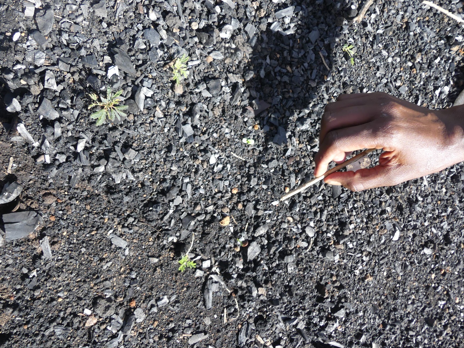
This one at 5 months of age and having defied the goats and dikdiks now faces increased elephant pressure and an uncertain climate future. But like most acacia trees...its tough enough not to worry to much ;) 

The local landowner showing us some of the thousands of sprouts on the many charcoal kiln sites. 


Differential germination rates from natural seed dormancy help spread regeneration over a few years with the acacia species. 

Lack of any other sprouts of any forbs or grasses shows a semi-sterile seedbed. 


Sunday, June 19, 2016

Aerial tree seed collection

Helicopter seed collection from natural stands has been going on since the 1970s using cone harvesters. 


Suggestions for faster collections

 Cone collecting is fastest where trees have fairly narrow crowns, tops have a heavy cone crop, cones are of good quality, cones are not opening (so every tree can be picked), and most trees in a patch have good crops. The biggest hindrance to a good cone yield is cones that are turning brown and therefore unusable.

 -A good pilot experienced with external load flying is the key to getting cones to the ground quickly.

 -Before starting a collection, locate key stands of heavy cone crop, check seed counts, determine the maturity of the cones and find suitable unloading and refuelling sites. This preplanning results in a smoother operation and higher production per hour. !

-Select unloading sites below the stand being raked because flying upward with the basket empty is easier than with it full.

-Whenever possible, transport a rake to the collecting site by truck or trailer. Aerial ferrying of rakes reduces helicopter airspeed to about 80-90 mph (130-145 km/h).

-Fly paths that minimize distances between trees. Generally, fly out empty and rake trees on the way back so that the longest flight is with an empty basket.

-A ground crew of two is best but one person can clean a rake.

-Self-dumping rakes can dump tops directly into trucks or trailers for transport to better sacking sites.

Generally, dumping sites should be less than two kilometres from trees, although the species and abundance of cones influence the cost/benefit ratio. The supply of Fandrich aerial rakes has never been a problem. Even during the heavy cone crop year of 1993 when all 49 Fandrich cone rakes were working, every request for a machine was met on time. Reserving a rake is part of a good collection plan. Availability of helicopters can be a problem, though. During hot dry summers helicopter companies may need to give priority to fighting forest fires and may not have a machine available for picking cones.


Material and information from http://www.coneharvesters.com/ please contact them for more information.


And for autonomous aerial tree seed collection  the Chang Mai University in Thailand is working on this > 


 Youtube video link to their amazing work here

Monday, June 13, 2016

Aerial tree seeding in East Africa - Some of the first things to consider.


Aerial reforestation is not a full replacement for planting seedlings by traditional methods. 


It is best considered as a potential complement to conventional planting and to natural seeding, an additional tool for foresters to use when the needs, sites, and species are appropriate. 


Sowing tree seeds directly in the field is an old technique but it was little used until the development of repellents to protect seed from insects, rodents, and birds. 
Today aerial seeding is already regarded as a practical reforestation technique in a few countries. There it is fully operational. More than a million hectares of well-stocked forests in the United States, Canada, Australia, and New Zealand demonstrate its success. Some of these forests have been established despite seemingly adverse conditions-for example, on steep slopes and on overburden from strip mines. 
Although aerial seeding technology has been used mainly in industrialized countries in temperate areas, it would seem the techniques could be modified for use elsewhere. Whether it will prove widely applicable in the arid tropics is still unknown. The uncertainties regarding its application in new regions lie mostly in whether the native animals and plants, as well as local climatic conditions, will permit its success. Nonetheless, sufficient knowledge has been accumulated in large-scale operations in North America and Australasia to justify wide-ranging trials in developing countries.

Currently in India Aerial seeding has been taking place to the tune of 1000's of tons of seeds being dispersed in conjunction with Navy helicopters.  http://www.thehansindia.com/posts/index/Andhra-Pradesh/2016-06-11/Vizag-regains-lost-greenery/234270 and also http://www.newindianexpress.com/states/andhra_pradesh/Aerial-Seeding-Operation-Comes-to-Vizag-Navy-to-Help/2015/08/31/article3002402.ece
When sites and species are right, aerial seeding can be as successful as the more conventional process of planting seedlings. For example, pine forests have been well established in over 90 percent of the attempts in the southern United States.

Direct Seeding


Aerial seeding is just one example of the more general process of broadcast seeding by which the seed may also be sown from the ground using mechanical spreaders or by hand. Ground-seeding methods will be preferable to aerial seeding in many situations in developing countries. In such cases, the principles and requirements are similar to those discussed here.

The advantage of the airplane is its ability to quickly seed large areas, even remote areas, when conditions for prompt germination and survival are best.


Aerial Seeding Sites
Aerial seeding is best suited to sites whose remoteness, ruggedness, inaccessibility, or sparse population make seedling planting difficult. It is particularly appropriate for "protection forests" because helicopters or planes can easily spread seed over steep slopes or remote watersheds and isolated upland areas. It seems well suited for use in areas where there may be a dearth of skilled laborers, supervisors, and funds for reforestation (Large tracts can be seeded so rapidly that supervising personnel are freed for other duties in a relatively short time. A ground crew of only three flagmen and two men to weigh and load seed are usually required). It has the potential to help increase production of tree crops for forage, food, and honey as well as wood for fuel, posts, lumber, and pulp. 
A deforested water catchment area on the South Mau Forest.


Aerial seeding can often be quickly deployed because there is no wait for seedlings to grow in a nursery (which may take 3 months to 3 years). It may be used on areas denuded by clear cutting or shifting cultivation. Also, sites of catastrophes such as forest fires, hurricanes, insect devastation, battles, volcanic eruption, or landslides can be promptly reseeded with useful tree species if seed is available (sometimes a deliberate burn or other technique may be needed to remove weeds and complete preparation of the seedbed). 
logging slash on Mt Kenya. 

For example, if a wildfire bares the soil on a remote watershed and makes it vulnerable to erosion, aerial seeding can be used on the ash-strewn seedbed before weedy species overrun the site. In some cases, a mixture of seed can be applied so that herbaceous plants such as mustard, grasses, or herbaceous legumes provide a quick ground cover that protects and "nurses" the young tree seedlings and suppresses undesirable weeds.

On the other hand, rapid deployment may not be practical in some cases because the site may require preparation or the season may be wrong.
To germinate successfully, seeds usually must fall directly onto mineral soil rather than onto established vegetation or undecomposed organic matter. Where organic matter has accumulated thickly, the site must normally be burned, furrowed, or disked. The soil disturbance left after logging is often sufficient. 

Rough terrain is especially amenable to broadcast seeding.


On certain sites ground preparation may be necessary. Site preparation and the seeding operation must be well coordinated to meet the biological requirements for prompt seed germination and seeding survival. Dry sites may have to be specially ridged or disked so as to optimize the rainfall that reaches the seed. Excessively wet sites may need to be ridged or drained.
The degree of slope is not critical as long as seeds find a receptive seedbed. Steep watersheds, eroding mountain slopes, bare hillsides, and spoil-banks where vegetation is sparse are often suitable for aerial seeding (however, on some steep slopes with smooth, bare soil, rain may wash the seeds away too easily for successful seeding). On steep strip-mine spoils in West Virginia and in Indonesia slopes of more than 30° (about 70 percent slope) have been successfully revegetated from the air.
Arid and savanna lands (for example, those where annual rainfall is under 500 mm) are most in need of reforestation. These are regions where aerial seeding in principle has exceptional potential. They include vast tracts of unused or poorly used land that has sparse tree cover and that is not confined to private land holdings, so it is generally accessible to aircraft. The native trees (such as species of Acacia, and other genera) in these areas are generally well adapted for survival under difficult field conditions. These are not species for timber as much as for firewood, forage, fruit, gum, erosion control, and other such uses. On dry sites, the amount of successful establishment is increased if the seed can be covered with a thin soil layer.

erosion narok
A potential ex-wheat farming site near Narok in dire need of rehabilitation. 
Species
As a prerequisite to any method of reforestation, the species selected must be adapted to the temperature, length of growing season, rainfall, humidity, photoperiod, and other environmental features of the area. Ideally, before aerial seeding takes place trial plots should be established to test those species most likely to germinate and grow successfully on the chosen sites. Even when one species has the right characteristics, it may be prudent to test seed of different provenances to find those best suited to the site.
Aerial seeding has been used mostly with conifers and eucalypts, although other species that reseed themselves successfully in a given region could also be aerially seeded with reasonable probability of success. However, in nature seed germinates over a relatively long period, and though environmental factors may be hostile at one time, they usually prove favorable at another. With broadcast seeding, only one or two applications are made, the seeds germinate together, and if timing is off, the results will be poor.


Characteristics that make a particular species appropriate for aerial seeding include:
. Small or medium-sized seed,
· Frequent and prolific seed availability;
· Ability of the seed to germinate on the soil surface;
· Fast germination and rapid seedling growth,
· Ability to withstand temperature extremes and prolonged dry periods,
· Ability to tolerate a wide range of soil conditions;
· High light tolerance;
· Seed that is easy to collect in large quantities and to store for long periods;
· Suitability of seed for handling with mechanical seeding devices; and
· Rapid development of a deep taproot by seedlings to enable them to withstand adverse
climatic conditions in the period following germination.


Species with highly palatable seeds have little prospect of success because wildlife eat the seed before it has a chance to germinate unless it is pelletized. Also, small seeds and lightweight, chaffy seeds are more likely to drift in the wind, so they are harder to target during the drop. (This can be compensated for by adding a thick coating to the seed.) Small seeds, however, fall into crevices and are then more likely to get covered with soil, thereby enhancing their chances of survival.
Aerial seeding may prove to work best with "pioneer" species, which germinate rapidly on open sites, are adapted for growth on bare or disturbed areas, and grow well in direct sunlight


An indigenous acacia xanthophloea seedling that has germinated from a biochar seedball. Please learn more about how it protects itself from browsers here Why is the African Savanna so full of thorns?


 Other Aerial Seeding Platforms


Crop Spraying Aircraft. 
This is the best way to do this on scale at short notice - the only company in Kenya, Farmland Aviation, who can currently do this on a large industrial scale can be found here. https://www.youtube.com/watch?v=kOWM_7kXWpg  - they can spread up to 2 tons of seedballs per hour over tens of thousands of acres.


Aerial seeding trial in the Mau Narok Forest - https://youtu.be/yG0toHGNJhY?t=20


Unmanned Aerial Vehicles

Current day low-cost UAV's that are available to the general public lack of payload capacity and range which limits them for most aerial seeding applications. Currently they seem to be best applied for use in mapping and monitoring forests.


There are a few new companies who are expanding this technology rapidly:


Paragliding:
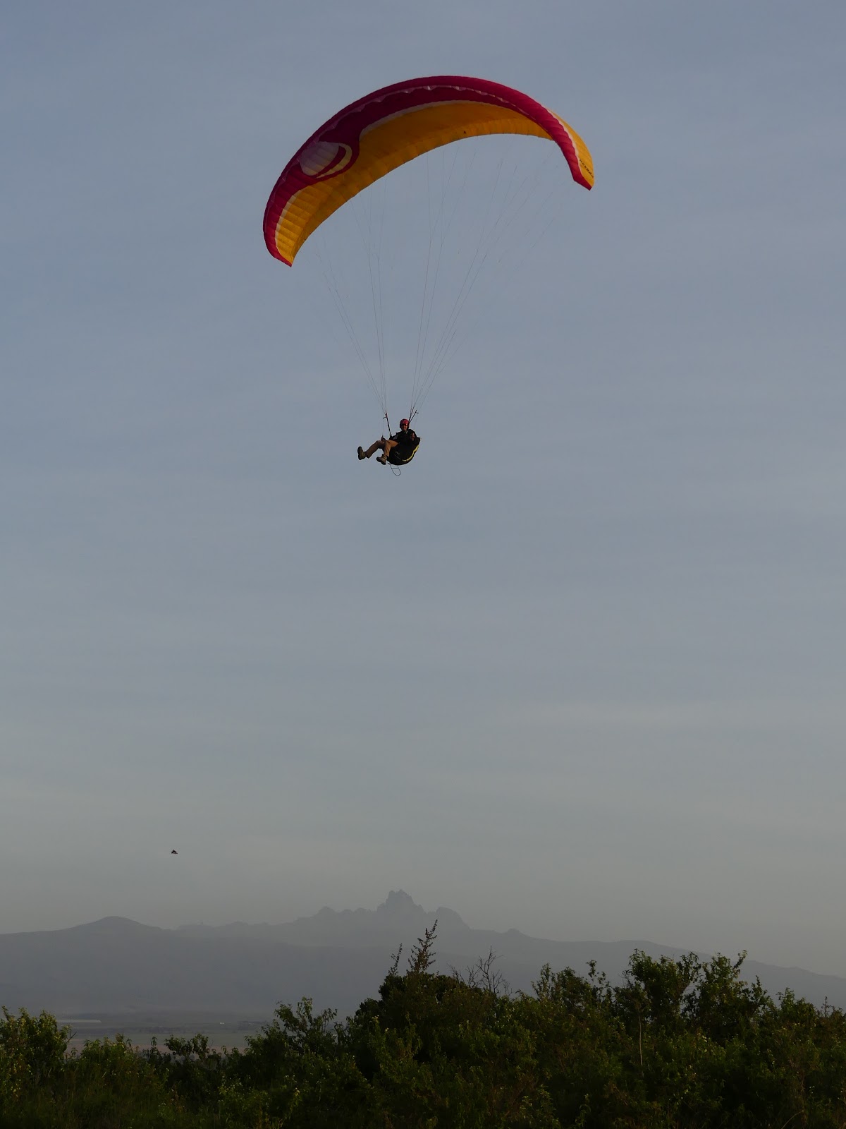
Quite possible one of the best methods we have seen so far of adding tree seed distribution to existing flight plans would definitely have to be at Borana Kenya, they sometimes throw out seeds as they take tourists on some of the most interesting adventure safari's in Kenya.


On the first proof of concept flight were able to carry about 2kgs (1,000+ acacia seedballs) on this first tandem trial. 


The Sky is the Limit for Tree Planting! 


Hot Air Balloons
A shrinking riverine forest is given a boost with SeedBalls from Musiara balloons. Daily.
Photo credit Alisa Bowen


For more information please see www.seedballskenya.com or email us on seedballskenya@gmail.com